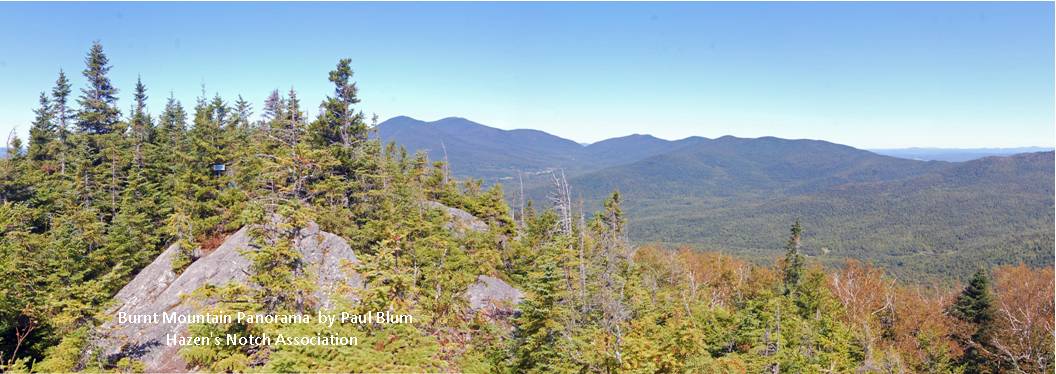
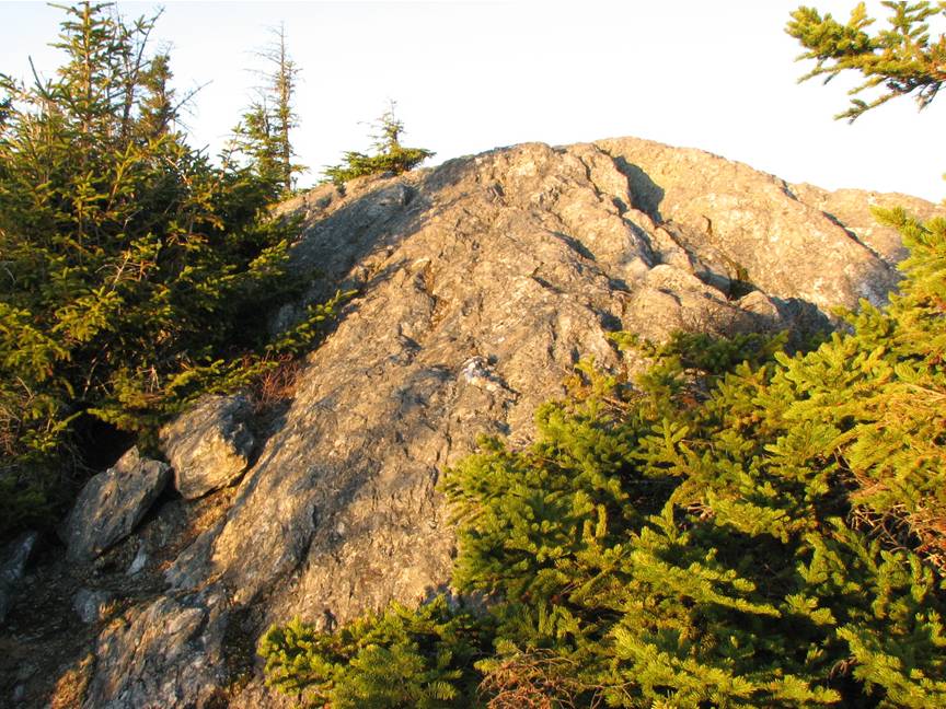
 Burnt Mountain panorama photo by Paul Blum |
Trails open to hiking May 9 - Nov 13, 2026.
Trails are CLOSED during rifle portion of deer hunting season Nov 14-29, 2026.
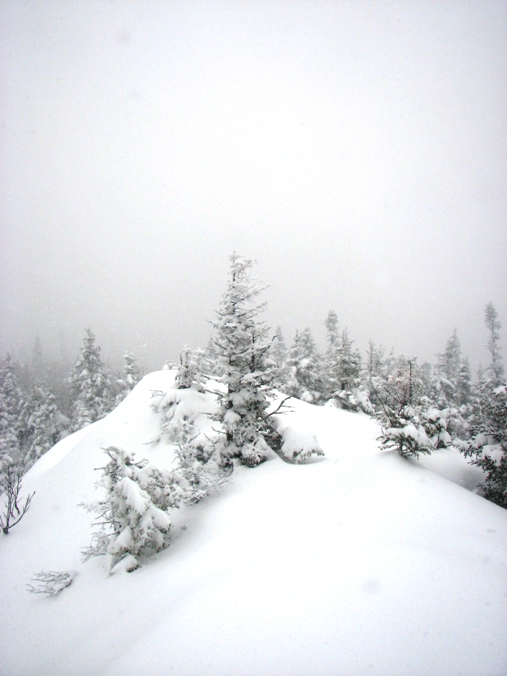
Trails opened to xc skiing and snowshoeing Dec 15, 2025 - April 1, 2026.
Burnt Mountain Conservation Area, Montgomery, Vermont
Visitor information, map, directions; official website
Burnt Mountain via High Ponds Farm Nature Preserve, Montgomery, Vermont
A Moderately Strenuous Half-day Hike2.4 miles each way; 1,400 feet vertical climb
HIKING DIRECTIONS: From the entrance to the High Ponds Farm Nature Preserve on the Rossier Road, follow the Beaver Ponds Trail to the junction with the High Meadow Trail. Turn left on the High Meadow Trail and continue in a Southerly direction to just past the wood shed. Turn left and walk along the stonewall to the Notch Trail. Turn left on the Notch Trail and then right at the junction with the Sunset Ridge Trail.
This trail is a woods road until it reaches the east-west-running ridge. It becomes a footpath and continues in an easterly direction to the main ridge where the trail turns right and continues in a southerly direction through a stand of Mountain paper birch (Betula paperifera v. cordifolia) on its way to the wooded summit and to the panoramic view beyond. Distance to wooded summit 2.05 miles, distance to viewpoint, 2.40 miles.
>> A recent video created by the Hazen's Notch Conservation Trust and posted to their Facebook page and Instagram account is meant to portray the Burnt Mountain Conservation Area. The video may give viewers the impression that the High Ponds Farm has been conserved. It has not. The video may also give viewers the impression that the Burnt Mountain Conservation Area and The High Ponds Farm are all one property. They are not. <<
Links to
1. Suggested routes to Moosewood Ponds, High Meadow and Burnt Mountain:
Suggested Routes updated January 2024.pdf
2. Map of High Ponds Farm and Burnt Mountain
High Ponds Farm and Burnt Mountain Area Map 2024.pdf
High Ponds Farm and Burnt Mountain Area Map 2024.png
 SPRING MUD SEASON: Trails are closed during Spring Mud Season. Starting in the third week of April, walkers may enjoy the flowers and song birds. At the High Ponds Farm Nature Preserve, do not walk past the High Meadow. The trail to the summit of Burnt Mountain opens in mid May. Thank you for your cooperation.
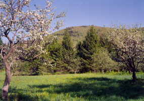
Montgomery, Vermont
"Today's hike up to Burnt Mountain summit was beautiful. Breathtaking panoramic views at peak foliage. One of the best summit views in Vermont. Hike was moderate, not too hard but some work going uphill. We plan on coming to ski in the winter.
Claudia Berger, October 2022
"The trail was easy to follow and nicely rewarding with a lovely lunch spot at the top where I enjoyed views of most everything that I explored in my week in the area. I could not have asked for better."
Chip Hartney, July 2021
"Awesome. Relatively easy hike to the summit, and a stellar view!"
Brian Barnett, October 2020
"Great trails."
Rich Douglass, July 2020
"Great XC skiing trails and wonderful hike up Burnt Mountain with views of Hazens Notch on top.
Hannah Halbreich, June 7, 2020
"One of my favorite places on the planet"
"High Ponds Farm at Burnt Mountain on Hazen's Notch is a beautifully (and minimally) managed cross-country ski and hiking area in Montgomery Center, Vermont. I'm not a skier, but spending countless hours hiking (or leisurely walking) on the trails in the summer, late spring and fall is a highlight of any day. Hanging out in the High Meadow in the Fall looking at the foliage or munching on an apple from the orchard, or in the summertime amidst the wildflowers, or sitting on a rock watching beavers swimming around in a beaver pond, or walking on a trail deep in the lush green forest, is akin to a religious experience in my book. I can't say enough about the beauty and peacefulness of this lovely place.
Janis Hess, February 2015
NOTE: The hike to the summit of Burnt Mountain passes through the High Ponds Farm Nature Preserve, a private property owned and maintained by the Anderson family. Other trails within the High Ponds Farm Nature Preserve connect to other areas within the trails maintained for hiking, snowshoeing and cross country skiing by the Hazens Notch Association.
Trails, parking areas and private roads and driveways may be closed at any time at landowners' discretion. Please observe and respect all signs, barriers, and gates to ensure continued public access. Thank you !
© 2008 Rolf Anderson
The summit of Burnt Mountain was relatively unknown prior to 1989. Rolf Anderson first discovered the spectacular view from the natural open rock outcrop on the summit ridge after several local people who had climbed the mountain told him that there was no view from the top. The Anderson family created the trail in 1990 with permission of the landowners at that time. Starting in 1993, they purchased the land to protect the natural resources and ensure continued public access from the High Ponds Farm boundary to the top of the mountain.
The Burnt Mountain Conservation Area lies within an area designated by the Vermont Department of Fish and Wildlife as a high priority, interior forest block for conservation. The Burnt Mountain Conservation Area has strong natural resource values which support native plant communities, biodiversity, wildlife habitat, wildlife corridor, structural and functional connectivity, numerous woodland seeps, vernal pools, and a stream which rises on the property.
© Rolf Anderson
In discussions with Wagner Woodlands in 1997 to acquire additional land on the summit ridge of Burnt Mountain, the Anderson family learned that the Vermont Land Trust and The Nature Conservancy intended to acquire the land owned by Wagner Woodlands which extended from the Anderson land southward toward Belvidere Corners, Vermont. With this purchase by the Atlas Timberlands Partnership (VLT + TNC), access to the summit was ensured through the permission of ATP. When the Vermont Land Trust wanted to sell their interest in ATP, the Nature Conservancy acquired the tract which included the wooded summit and viewpoint on Burnt Mountain. A "forever wild" conservation easement is held by the Northeast Wilderness Trust.
Additional Information The Hazen's Notch Conservation Trust (HNCT) conserved a 160-acre woodland on Burnt Mountain in Montgomery, Vermont on November 13, 2023. The conservation easement held by the trust protects the natural resources, wildlife habitat and two popular pedestrian trails on the Burnt Mountain Conservation Area. For more information >> Burnt Mountain Conservation Area